Presentation Topic: Leveraging ArcGIS Hub for Digital Infrastructure Design Delivery
**New Venue Location – Details Below**
Registration: Registration for this event is now closed.
Abstract: Infrastructure Ontario and Metrolinx are working together on delivering the Ontario Line, a proposed CA$10.9 billion rapid transit line in the City of Toronto officially announced by the Government of Ontario on April 10, 2019 with a completion date projected for 2027. This 15.5 kilometer (9.6 miles), free-standing and underground subway line, with 15 proposed stations, will run from Ontario Place/Exhibition Place through the heart of downtown Toronto to the Ontario Science Centre. The Ontario Line is designed to alleviate crowding on existing lines, cut down commute times, and connect previously unconnected communities across town.
A technical advisory team, consisting of nearly 1,000 multidisciplinary staff from numerous agencies and engineering, design and environmental firms, was tasked with the development, design and digital delivery of the project. During the duration of the project the team will develop hundreds of federated 2D and 3D design models of the alignment, platforms, stations, tunnels and structures utilizing a plethora of tools and software such as Revit, Civil 3D, Infraworks, BIM 360, PowerBI, SharePoint, and ArcGIS
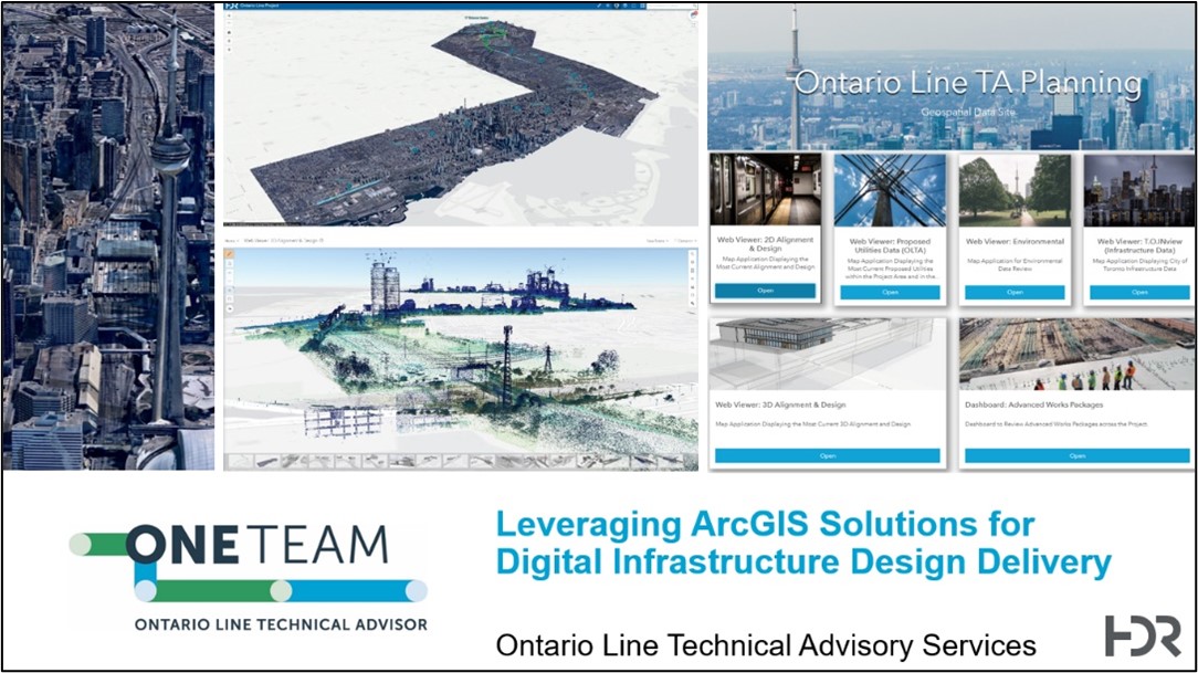
In order to effectively organize staff, data, and tools across the large project team, the Geospatial and Information Management (GeoIM) team conceptualized and developed the online Ontario Line TA Planning Portal. Based on Esri’s ArcGIS Hub cloud platform, the portal provides easy access to data and information via a suite of discipline-specific web applications for reviewing the latest 2D alignment, properties, utilities, environmental impacts, and 3D station design. Since its inception the hub has proven invaluable serving as a one-stop-shop for the project team to conveniently access and holistically view the latest 2D alignment and design data in a simple yet powerful web viewer and to assess potential property parcels takes and environmental impacts. A 3D viewer allows the team to explore the latest station and structures design which is being brought in directly via ArcGIS Pro from the Autodesk BIM 360 platform and then meshed up on the fly with 3D imagery of the project corridor. Another module depicts the 4D construction phasing by accessing schedule information dynamically tied into the design models. The construction phasing logic is also integrated into operations dashboards which are accessible on the hub site also.
This presentation will discuss and demo the setup and configuration of the hub site and its various web application, the automation of the conversion processes for both the 2D and 3D design data into GIS, and the visualization and mesh of the BIM station data with the alignment and 3D city scape.

Presenter: Bridget Wagner, GISP
Speaker Bio: Bridget Wagner, GISP is the East Region GIS Coordinator and Mid-Atlantic GIS Section Lead for HDR. She has 12 years’ experience in the development and management of GIS solutions for transportation projects. Over that time, she has lead GIS efforts (data collection, application development, asset management) for large DOT programs and private agencies. She has a detailed understanding of spatial database management concepts for roadway infrastructure. These skills and experiences enable Bridget to analyze complex assets and field data and translate them into insightful, dynamic datasets. Bridget has integrated cloud and web-based mapping solutions, as well as standardized database schemas, for project management, asset management, field work coordination, and stakeholder engagement. Bridget is committed to improving project efficacy and streamlining delivery through digital spatial solutions. In her free time, she enjoys running throughout the City and exploring the Richmond food and drink scene with her husband, Jeff, and labradoodle, Macklin (she goes everywhere they go!).
When: Thursday, August 11, 2022 at 11:45 AM
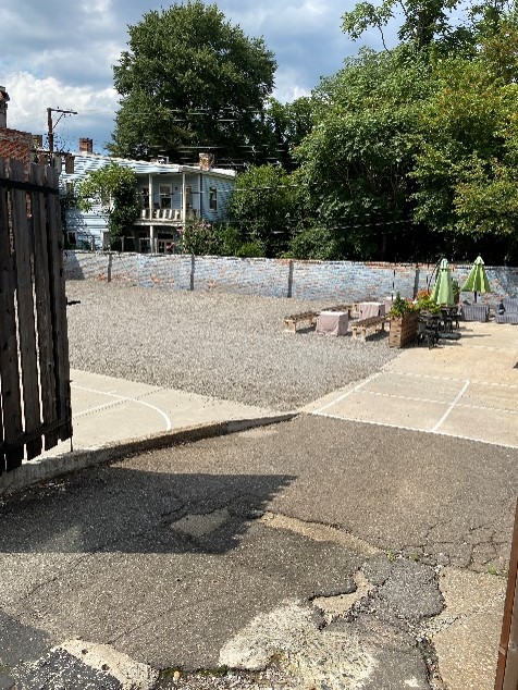
Where: 2810: a community gathering place, 2810 W Cary St, Richmond, VA 23221
Reserved parking spaces (shown in picture below) on either side of building and gravel lot (15-20 cars) accessed through gates adjacent to building.
Attendants will receive 1.0 PDH from this technical meeting. Cost is $30 for members and $35 for non-members. Price will increase August 10th. Lunch will be provided (Coppola’s Deli).